University of Texas at Austin

News

Scientists Simulate Weather Beneath the Ocean

By Rebecca Riley

Published Feb. 15, 2023

The Gulf Stream. Credit: NASA/Goddard Space Flight Center Scientific Visualization Studio

Researchers at the Oden Institute for Computational Engineering and Sciences at The University of Texas at Austin are simulating oceanic weather with greater accuracy than ever before.

Published in the Journal of Advances in Modeling Earth Systems, their findings allow mesoscale eddies — chaotically unpredictable swirls of seawater — to factor into global climate models.

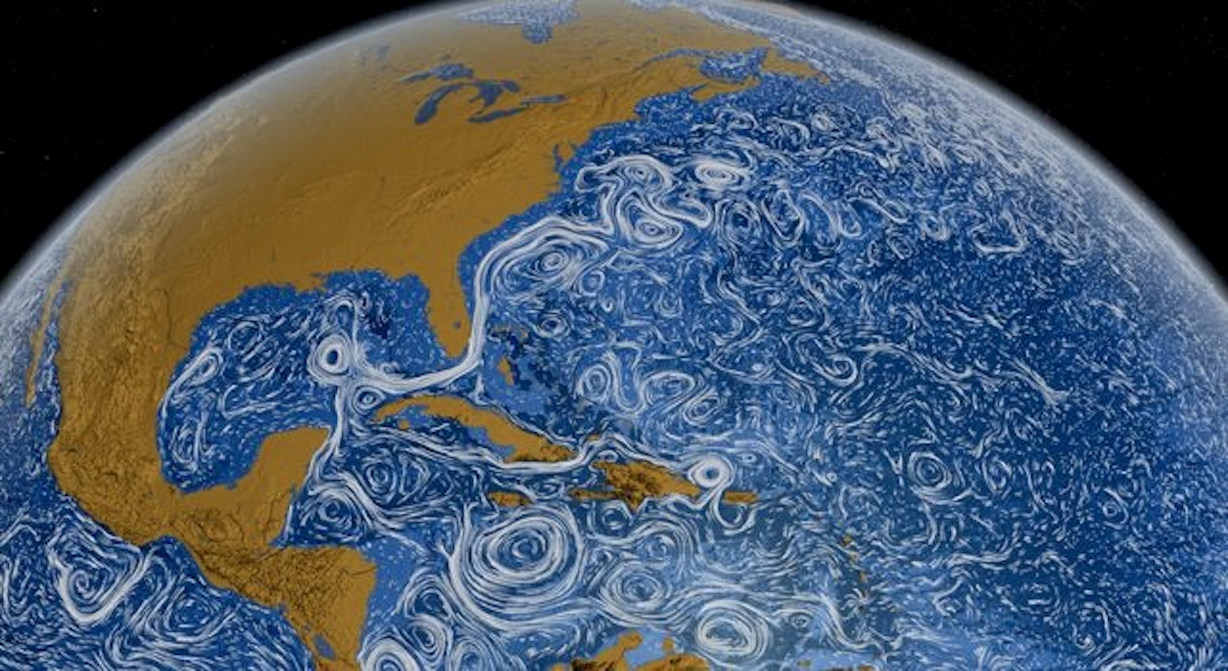
Known by sailors for centuries, mesoscale eddies are challenging to represent in global ocean simulations. The reason? Most are about 100 kilometers wide while most global climate models are about 10,000 kilometers in scale — the difference is the length of a road trip from Chihuahua, Mexico, to the North Pole.  

“When you’re modeling climate, you’re working on a scale so large that most major cities cannot be captured,” said lead researcher Sina Khani. “Mesoscale eddies exist in smaller scales. It is very computationally expensive, even impossible, for a global simulation to resolve them all.”

For reference, a model capable of showing Planet Earth down to its individual whirls of seawater would use more storage memory than currently exists across the world. 

“Because mesoscale eddies are important in ocean transport, but very expensive to resolve in a climate model, we need to parameterize them, meaning providing an approximation to what’s really happening,” said Clint Dawson, who collaborated with Khani on this project. 

The series of equations they developed works like a plug-in for global climate models, allowing the models to do more than they were built to do. 

Unlike current climate models, the new parameterization can capture ‘meanders’ — a type of mesoscale eddy that moves by slithering like a snake. Meanders transport heat and carbon around the world. Some carry water from the Indian Ocean far into the South Atlantic. 

Current mesoscale parameterizations don’t account for the sea mounds and continental barriers on the seafloor that bring these currents into existence. By using a gradient of structures at the bottom of the ocean, Khani and Dawson’s model captures the way this rough topography churns seawater into meanders. 

block.caption

A topographically rough seafloor that shapes the way seawater flows around it.

The two researchers developed and ran their work with supercomputing resources at the Texas Advanced Computing Center (TACC). Without the help of the Stampede2 and Lonestar6 supercomputers, the new model could not have been run in a resolution high enough to capture mesoscale eddies, according to Khani. 

The researchers plan to test their new model on the realistic ocean bathymetry of the Southern Hemisphere and Gulf of Mexico. Their work was funded by a U.S. Department of Energy project that looks at climate impacts on the Gulf of Mexico. 

“We’re grateful to the Department of Energy for their support for this,” Khani said. “Global ocean models are used by many government agencies in their decision making. For example, the National Hurricane Center uses the outputs of global ocean models to predict hurricanes and storm surges.”